One of the most popular waterfalls in Bulgaria is located only 20 km from Veliko Tarnovo – the old capital of Bulgaria.
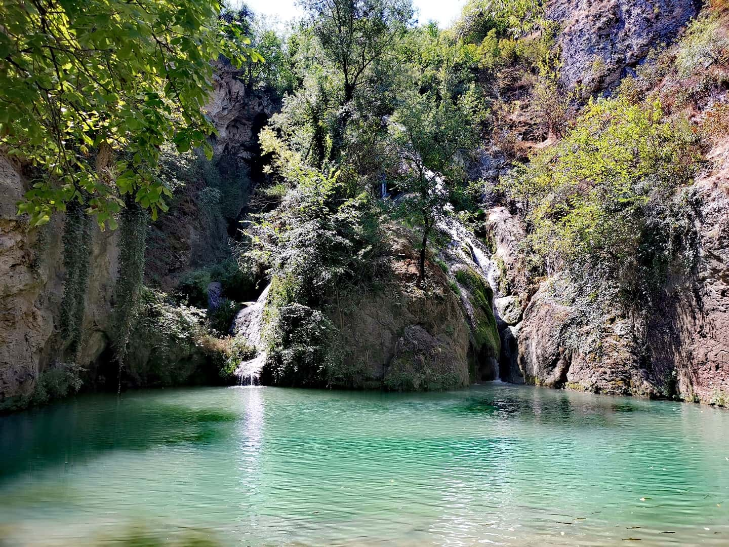
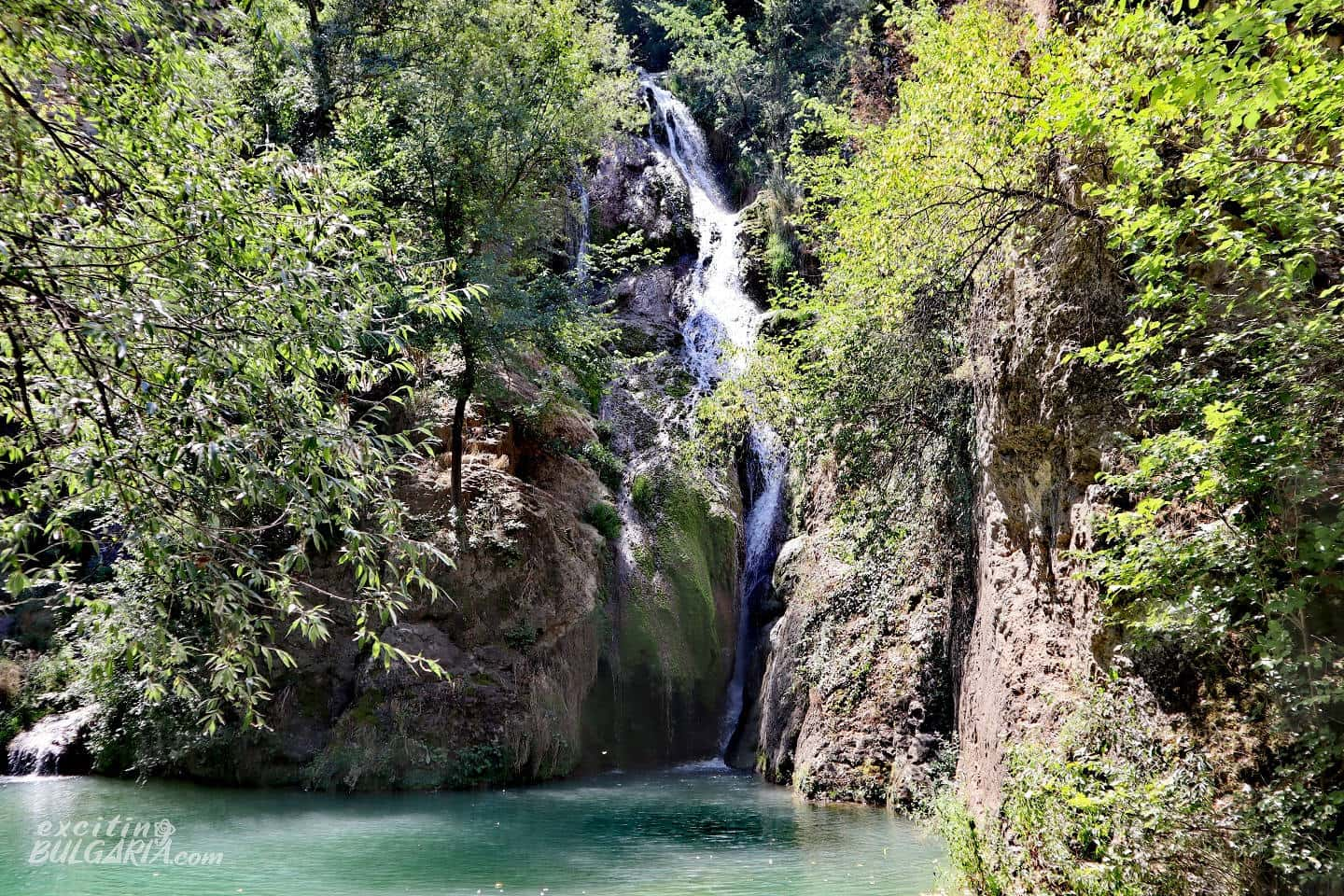
With its 30 meters height, Hotnitsa waterfall may not be among the highest waterfalls in the country, but it is still the highest waterfall in this region. It is also one of the most photographed Bulgarian waterfalls. The waterfall works all year round – it is much more full in the spring after the snowmelt, but in return, it does not dry out during the hot summer months.

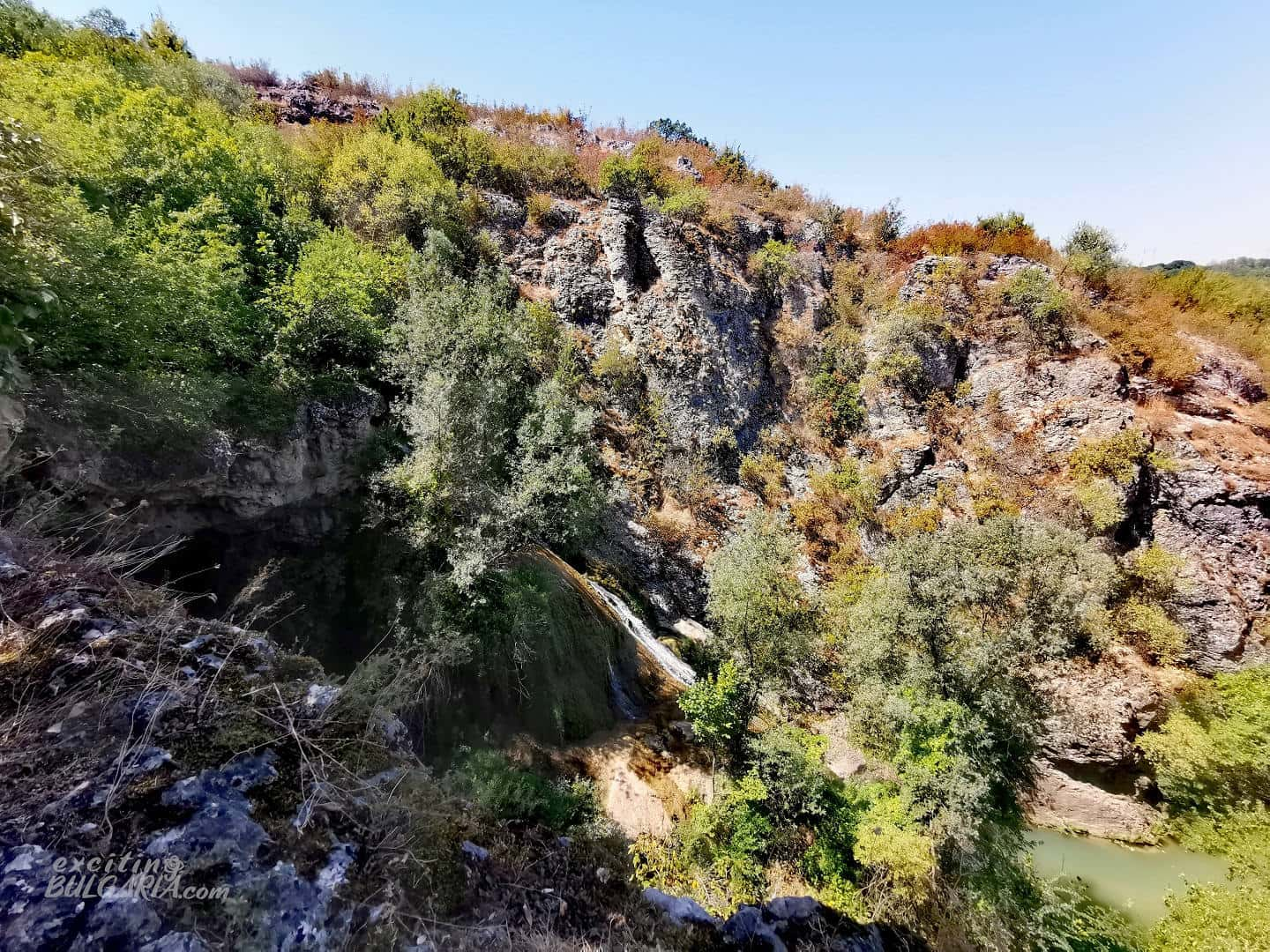
Hotnitsa waterfall represents the natural end of the gorge of the river Bohot passing through Tarnovo Heights. The river is 32 km long and springs near the village of Novo Selo, passes through the village of Balvan and then past the village of Hotnitsa to continue to the Danube plain. It finally flows into the Rositsa River, not far from the remains of the ancient Roman city of Nicopolis ad Istrum.
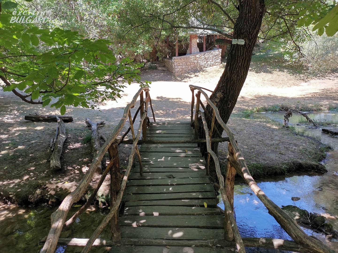
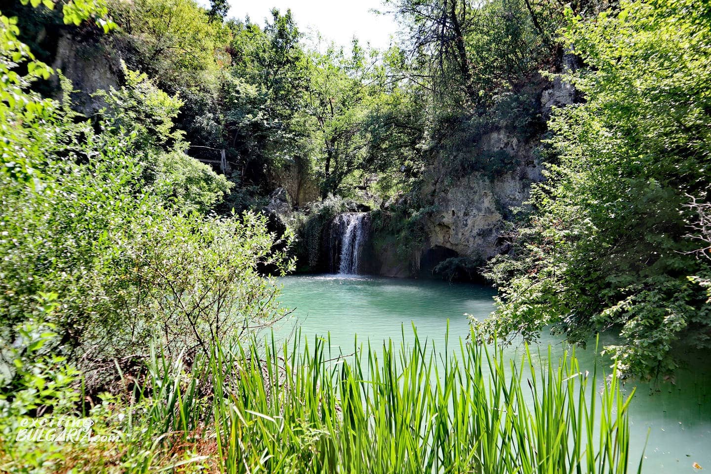
It is very easy to get to the waterfall and you can park your car just a few meters away. After crossing a small wooden bridge, you will find yourself on a meadow that reveals an amazing view of the waterfall. There are also several wooden benches and gazebos making it a perfect picnic place.
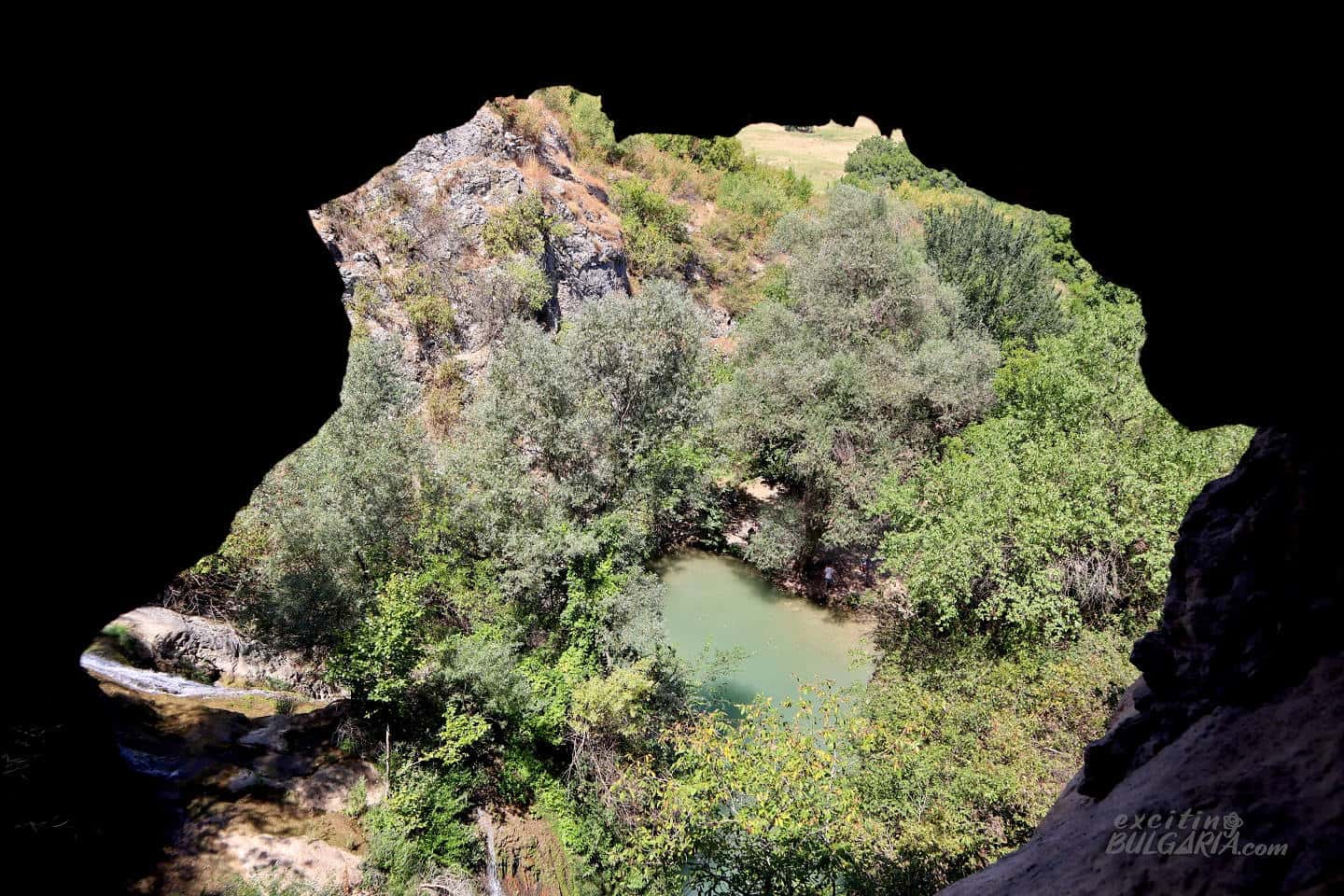
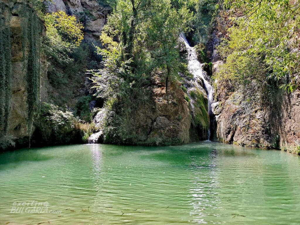
From there, you’ll notice that the waterfall splits into two streams – the water spills on both sides of a huge rock. They eventually dissolve in an emerald-colored pool.
The waterfall and the river gorge have been declared a natural landmark and protected area in 1971. For several years there has been a built hiking trail next to the waterfall, with many bridges and wooden stairs, making the walk along the waterfall and up the river much more pleasant. Hotnitsa waterfall and the eco-trail are a favorite place of many tourists as they are easily accessible and offer the unique tranquility of nature.
Hotnitsa waterfall is also known as Kaya bunar, which comes from Turkish and means ‘spring in the rock’.
Hotnitsa waterfall eco-trail
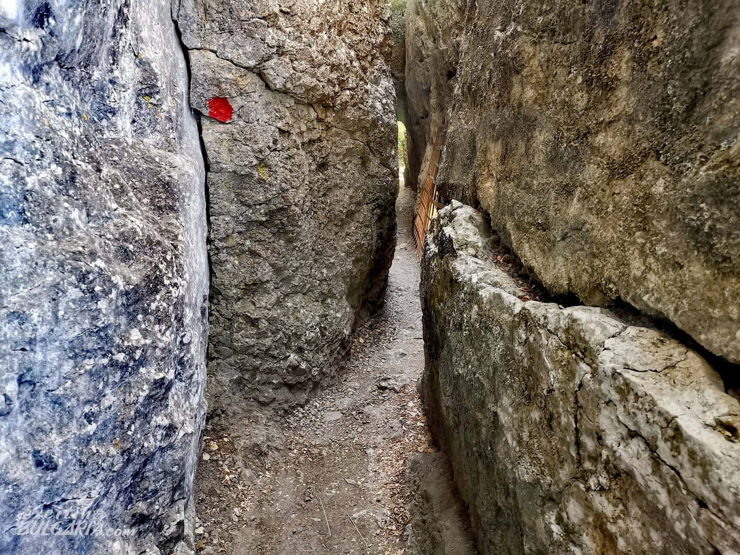
The trail begins on steep stairs to the left of the waterfall, revealing scenic views of the waterfall. It is about a kilometer and a half long and doesn’t take more than an hour to walk through it. The route goes up the river and reaches the top of the canyon, traversing the entire cascade of the waterfall system on the Bohot River.

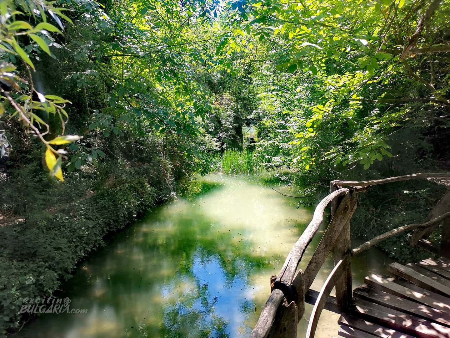
Built in 2006 under the Middle Yantra Project with funding from the PHARE program, the trail is a string of thresholds, water cascades, ponds, small waterfalls and wooden bridges. There are a total of eight bridges along the route.
The trail starts with stone steps up, which reach a small platform just above the big waterfall. Then it continues further up, alternating stone and wooden steps and bridges.
After the first wooden ladder, there is a beautiful panoramic view of the nearby fields. Then the trail passes through a narrow rock tunnel, which is believed to have been cut in ancient times when there was a mill there.
From here, you can see where the water of the river descend and the waterfall originates. Further up the flow, there are some interesting small waterfalls.
At the top, there is a wide meadow with a fountain for watering animals. The road to the nearby settlements passes nearby on the plateau, which you can take to return to the parking lot in front of the waterfall, but it is way more scenic to go back along the trail.
Please note that in some places the trail is anything but suitable for people with limited mobility. Despite recent maintenance works, some of the stairs are very steep, and railings can be unstable.
When to visit Hotnitsa waterfall
Thanks to its easily accessible location, Hotnitsa waterfall can be visited any time of the year. Its altitude barely exceeds 100 meters above sea level therefore does not play a role in the weather there.
The region of Veliko Tarnovo is most beautiful in late spring, which also applies to the vicinity of the waterfall. This time of year, the waterfall is full of water due to snowmelt and heavy spring rains. With all the lush greenery around, this is definitely the best time to visit the place.
As this waterfall never dries out, it is worth a visit, even in the summer months. There is enough water in it even in late August but obviously much less than in the spring. Winter months are considered the least favorable time of the year to visit the Hotnitsa waterfall because the steep stairs can freeze, and the wooden pavement can also get very slippery.
Location
Hotnitsa waterfall (or Hotnishki waterfall, BG: Хотнишки водопад) is located about 20 km from Veliko Tarnovo, 2.5 km west of the village of Hotnitsa. It can be reached by car on an asphalt road from Hotnitsa, which leads to the meadow in front of the waterfall. There is a free car park at the end of the road, very close to the waterfall.

Please be aware that there are no amenities around, so make sure you bring your own food and drinks.
Map
What to see nearby
As mentioned before, the historic town of Veliko Tarnovo is only about 20 km away. If you’d like to explore a bit farther, UNESCO World Heritage Site Ivanovo Rock Hewn Churches, the Cherven Fortress, Orlova Chuka Cave or the Basarbovo Rock Monastery are all within an hour and a half by car.