Last updated on 20 March 2023
Hidden deep in the Rhodope Mountains, Devil’s Bridge is full of mystical beauty, surrounded by beautiful nature and impressive views.
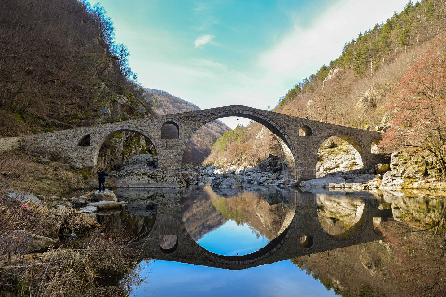
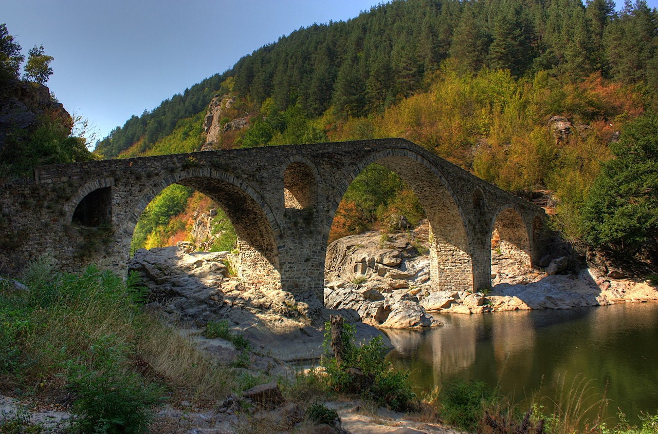
Devil’s Bridge is built in a picturesque gorge over Arda, the longest Rhodope river, 420 m above sea level. The gorge is flanked on both sides by steep, wooded slopes. Although the region has a few similar stone arch bridges, Devil’s Bridge overshadows all of them with its massive size. The 56 m long, 3.5 m wide stone bridge forms three arches with the main arch reaching a height of 11.5 m.
In Roman times, it is said that there was another bridge at this place, part of the Via Egnatia road, connecting the Aegean Sea with Thrace. The current bridge was built between 1515 and 1518 by the rule of the Ottoman emperor Sultan Selim I. In over 500 years, no maintenance has been required on the robust structure.
It’s unclear how exactly the bridge got its name, but it has been associated with many legends over the years. According to one of them, between 11 am and noon, when the bridge and its reflection form a circle, the face of the devil can be seen on the waters of Arda. Another story suggests that one of the stones shows an imprint of the Devil’s footprint left during one of his walks on the bridge.

There is a legend about the construction as well. For a long time, no one could build a bridge over the raging river because its waters destroyed every attempt. A young craftsman, called Dimitar, took on the difficult task of building it. The devil promised the master to share a secret that would make his creation last forever if he could complete the construction in 40 days. If he failed, however, he would take his soul. Dimitar accepted the challenge, and the devil fulfilled his promise, but the gifted master died soon after, taking the secret to the grave.
Another folktale tells the story of a young girl chased by the Turks many years ago. One of them was in love with her and wanted to make her part of his harem. She climbed the bridge to jump into the water. When the Turks approached the bridge, they stopped frightened as they saw the face of the Devil mirrored on the river.
In fact, devil’s bridges exist in several places across Europe that are mostly medieval stone bridges. Apart from architectural similarities, these bridges have another thing in common – they all have myths linked with them that refer to the devil in some way.
Sultans Trail, an international long-distance hiking and cycling trail crosses the bridge between Ardino and Kardzhali. The 2500 km long trail starts at St. Stephen’s Cathedral in Vienna, passes through Austria, Slovakia, Hungary, Croatia, Serbia, Bulgaria, Greece and Turkey to end at the tomb of Sultan Suleiman the Magnificent in Istanbul. It is estimated that the whole trail can be completed in 15 weeks by foot or around 4 weeks by bike.
The abandoned village of Dyadovtsi
Be aware that the Devil’s Bridge is not the destination where you can spend a whole day walking around and taking indeed amazing photos. After having lunch on one of the benches around the bridge, you might be interested in visiting the abandoned village of Dyadovtsi where you can stop by for a little time travel and to take some pictures.
Dyadovtsi used to be one of the largest villages in the region, its population was reaching 400, according to local estimates. The village was electrified, had over 60 inhabited houses, a shop, a town hall and even a school. The major relocations from the settlement to larger towns and Turkey started in the 1950s, followed by subsequent waves in the next decades. Today, Dyadovtsi is completely depopulated. The large, two-story houses with their specific architecture are totally deserted, nature is making its way through the doors and windows.
Don’t let the names confuse you, the road between Ardino and Devil’s Bridge passes through a village marked as Dyadovtsi, but that is the new village of the same name. The abandoned village can be found to the left of the asphalt road when you’re heading to the bridge. There is no road sign, but the ruined houses can be seen from the road. GPS coordinates of Dyadovtsi: 41.614550 N, 25.123976 E.
How to get to Devil’s Bridge
Devil’s Bridge (BG: Дяволски мост, Dyavolski most) is located in the eastern part of the Rhodope Mountains, 9 km from the town of Ardino, 42 km from Kardzhali and 64 km from Smolyan. The bridge can be reached by an 18-minute drive from the center of Ardino following the brown road signs. To get to the bridge from Ardino without a car, you’ll need to hike or hire a private service as public transport isn’t available.
After the road starts to follow the river, there will be wider areas where you can leave your car. Shortly before the bridge, there is a booth where a small entrance fee (a few levs) is collected. GPS coordinates of Devil’s Bridge: 41.620594 N, 25.114167 E